Finn din drømmereise
Hike a spectacular Alpine trail from Chamonix to Zermatt
Hike a spectacular Alpine trail from Chamonix to Zermatt
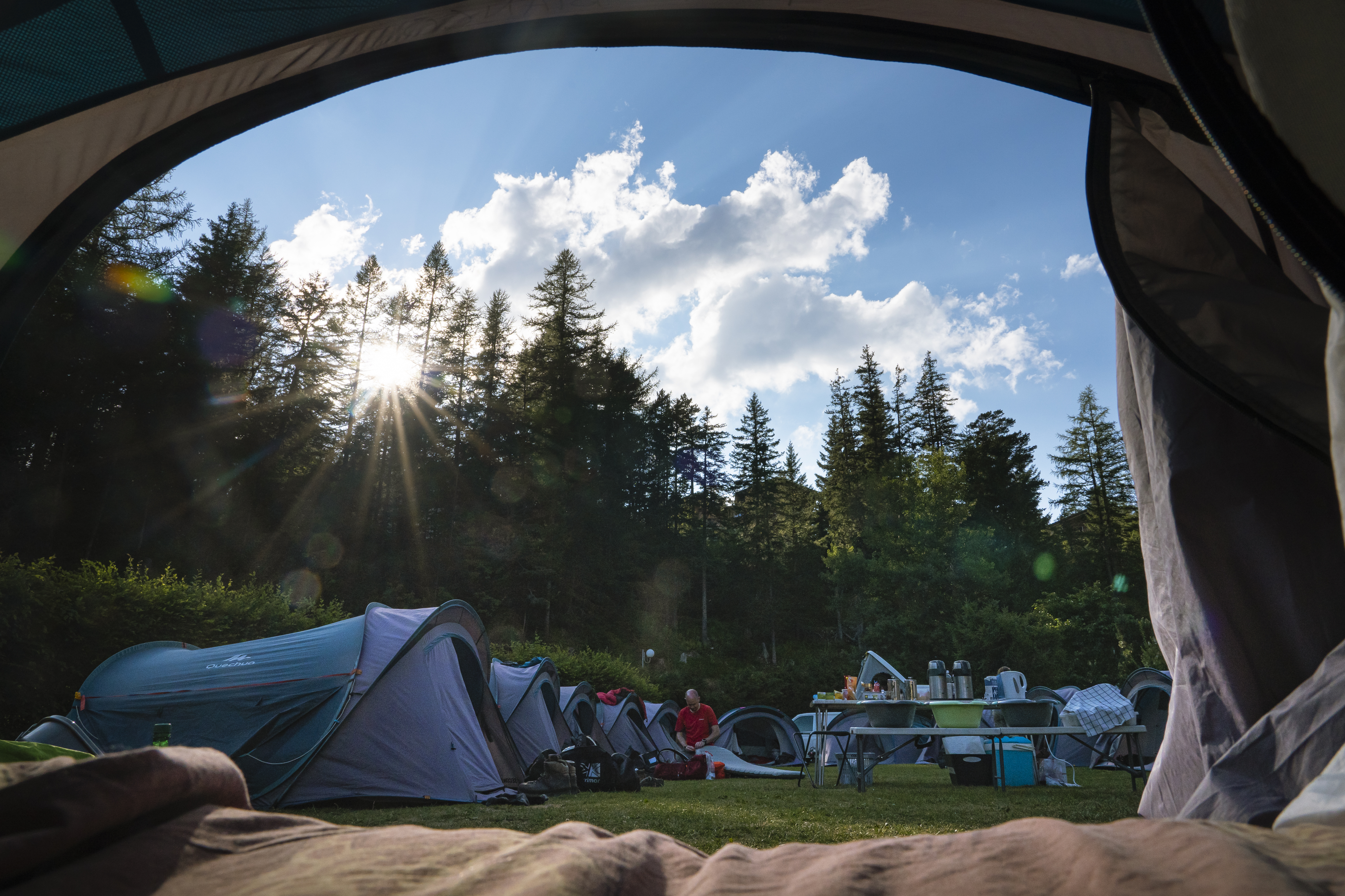
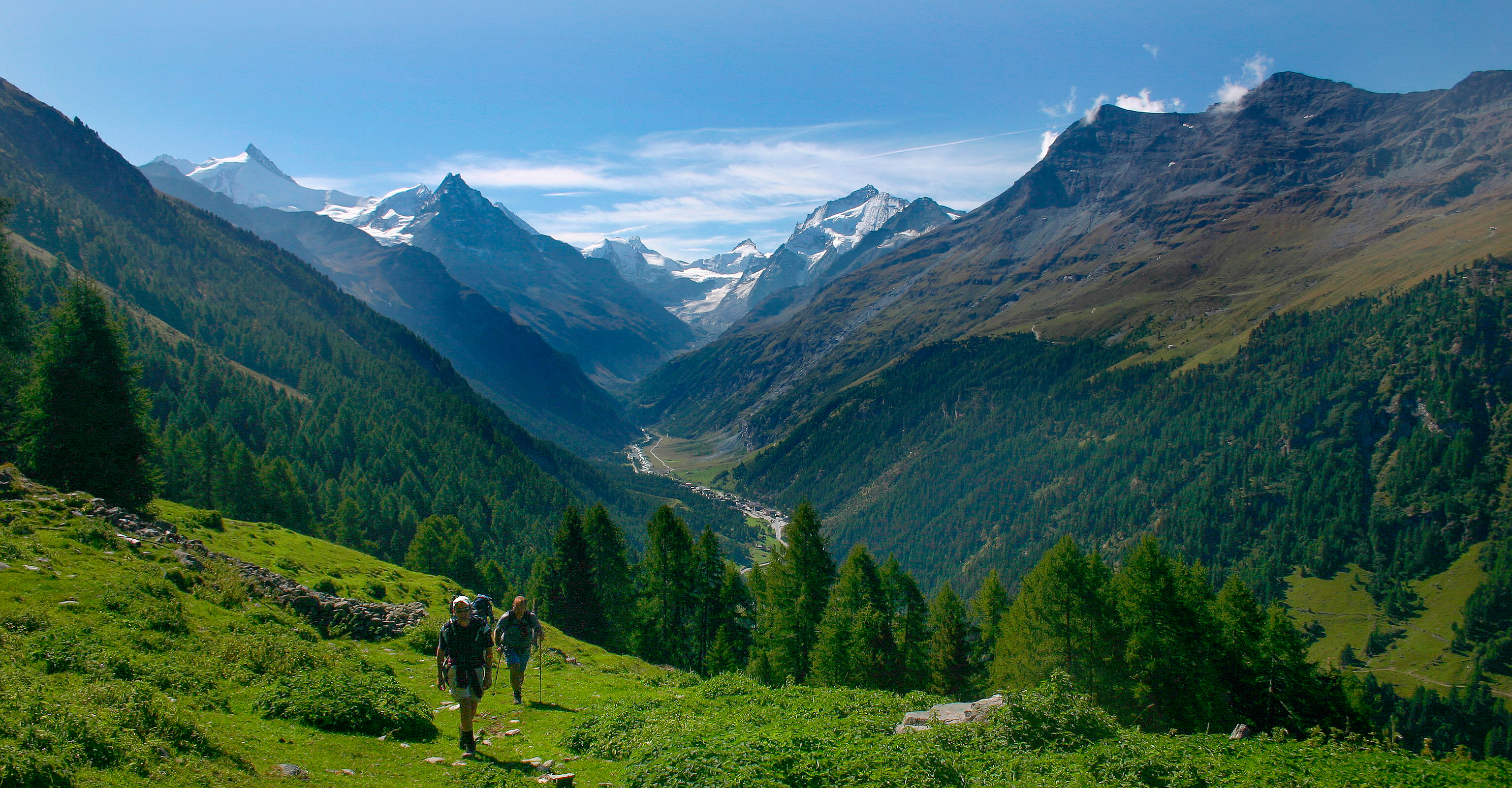
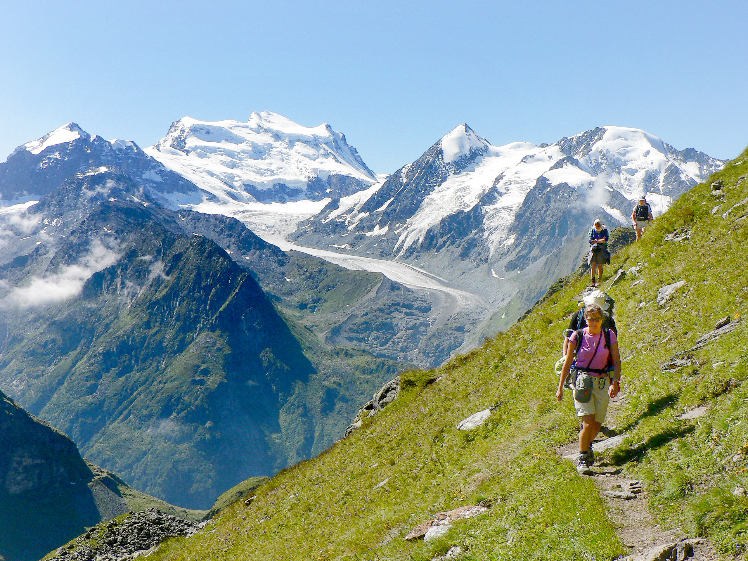
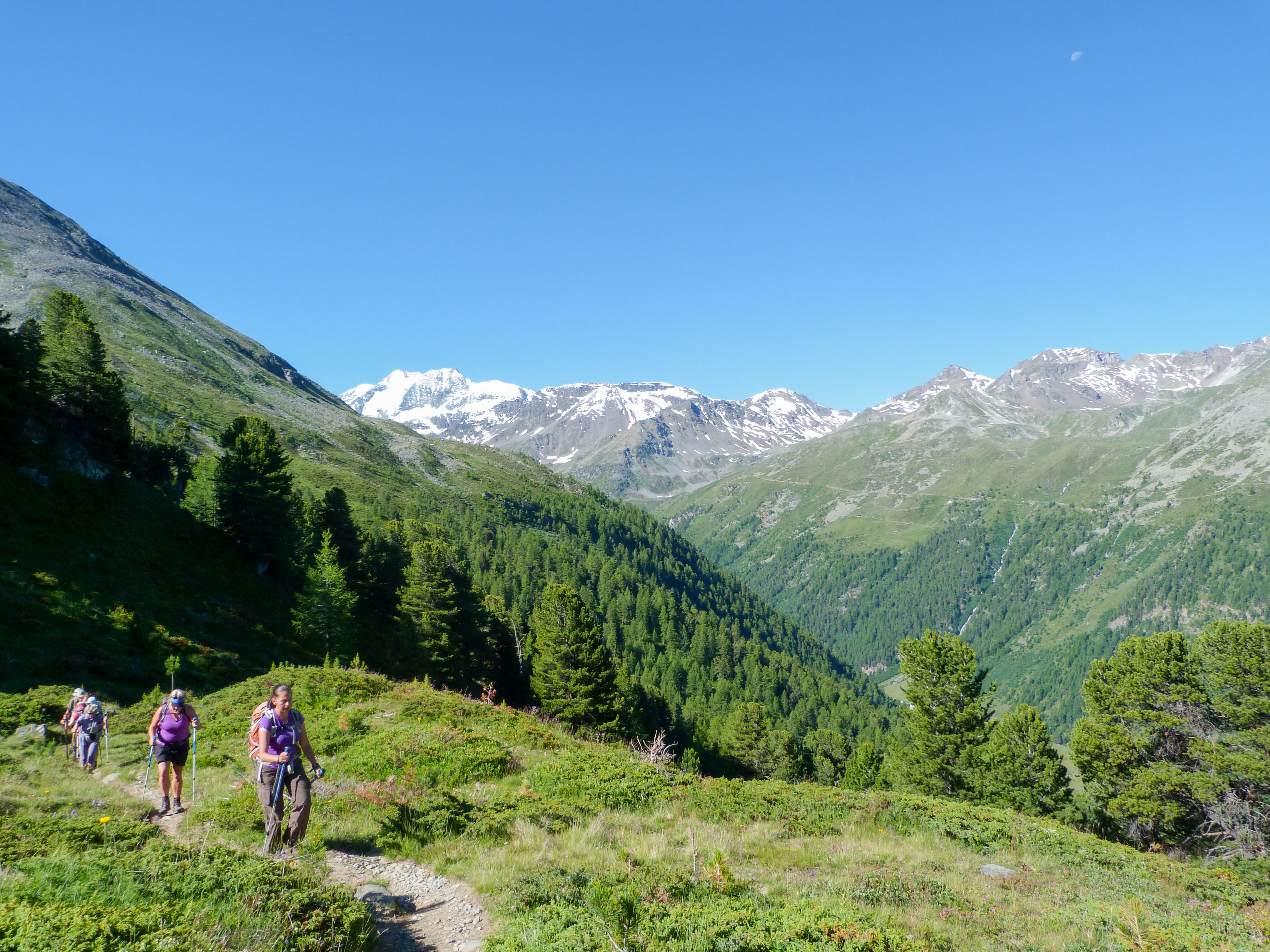
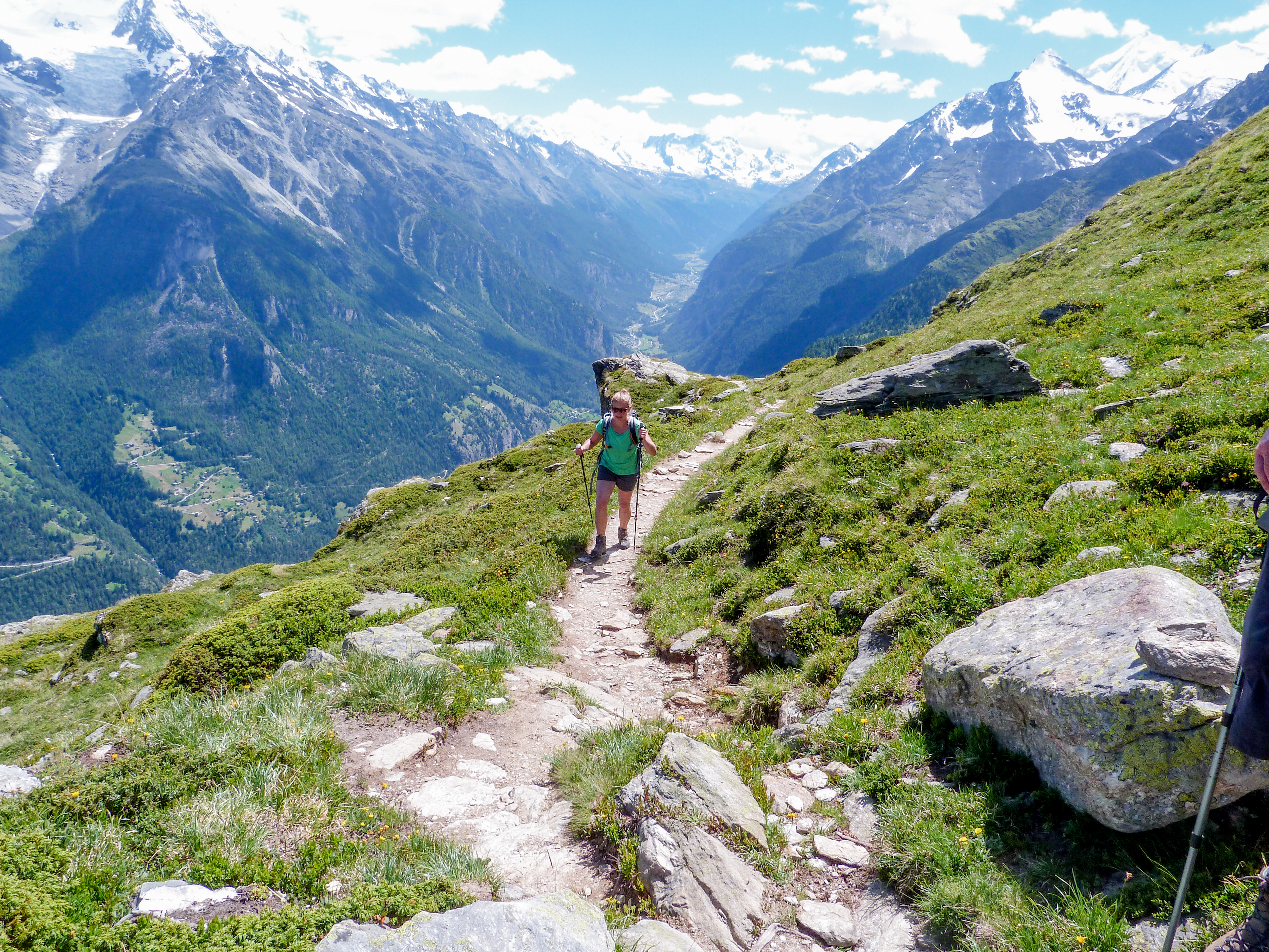
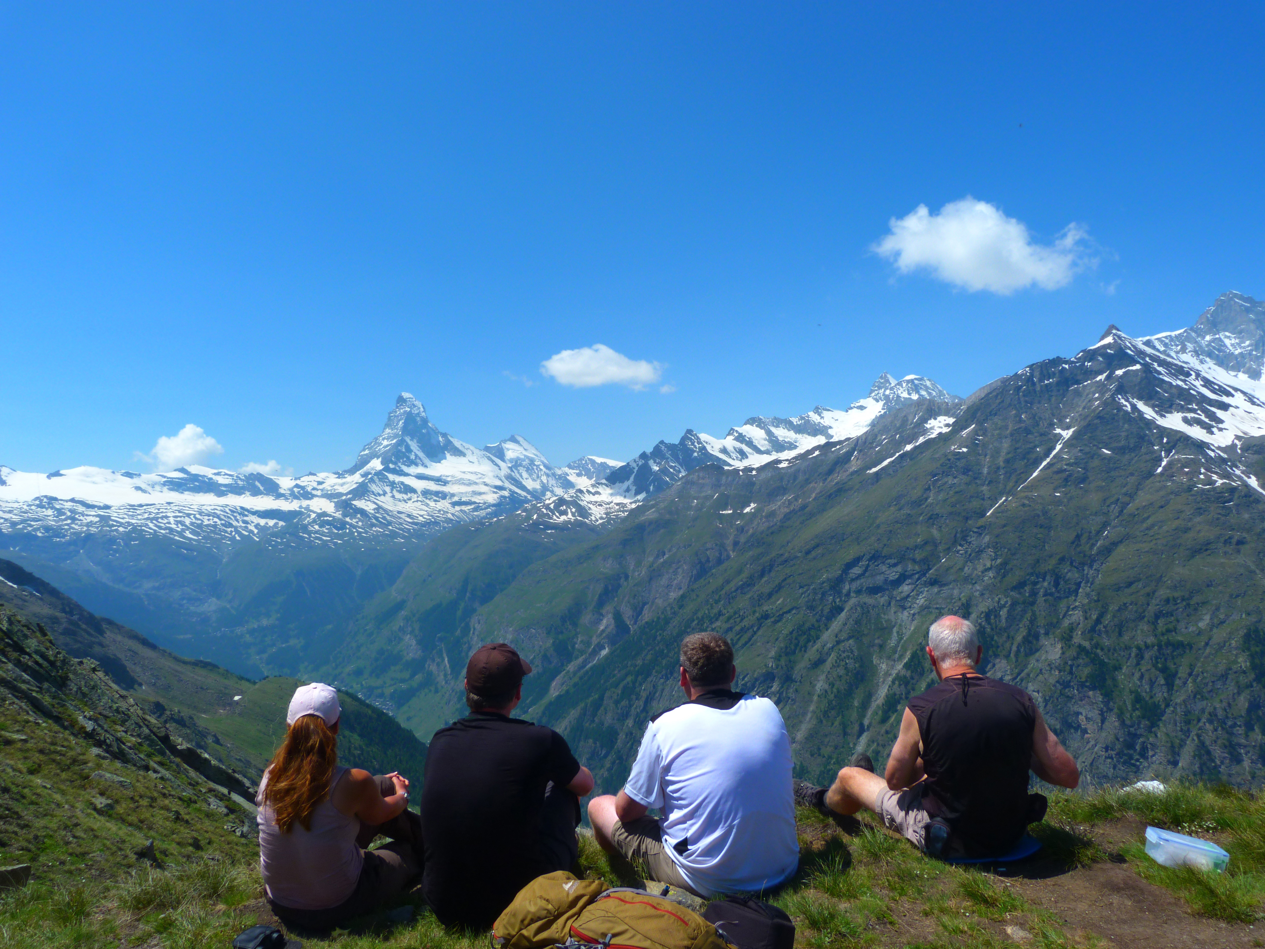
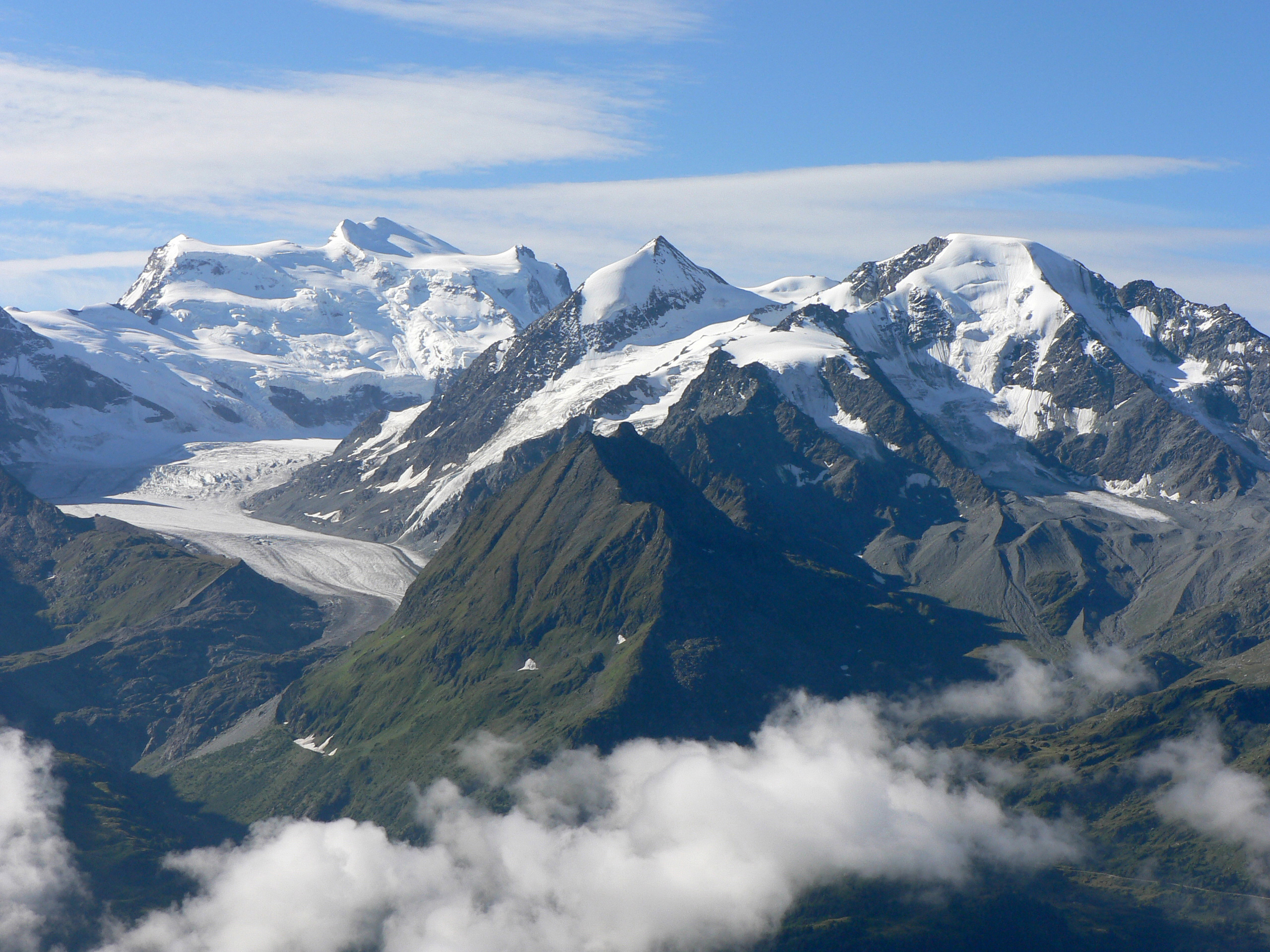
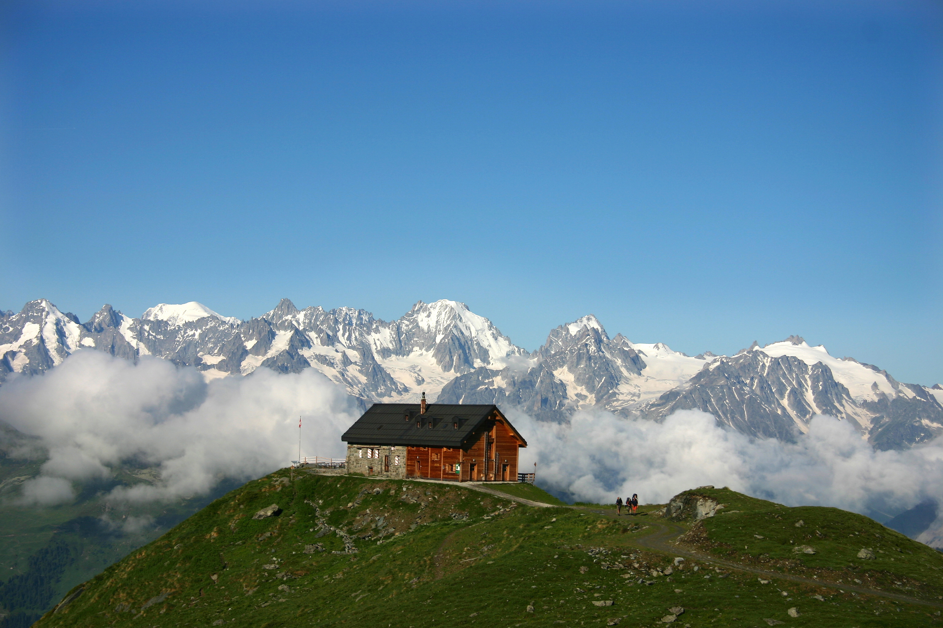
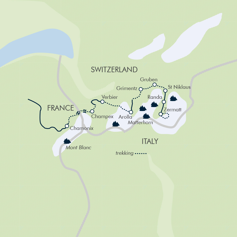
The Haute Route is one of the best-known long-distance ski-touring routes in Europe; running roughly parallel is a spectacular summer trek from Mont Blanc to the Matterhorn. Covering approximately 100mi (160km), it links the valleys of the Haute-Savoie in France to the Swiss Valais. Following our guide, a qualified International Mountain Leader, we pass beneath 10 of the 12 highest mountains in the Alps. Walk through a landscape scattered with glistening glacial lakes and lush, undulating valleys by day and sleep in remote Alpine huts and under canvas by night.

Expect fair weather from late June to early October, but all mountain ranges create their own weather patterns and the Alps are no exception. It can and does rain and it can be surprisingly cold at times, especially on the high passes.
Expected daytime temperatures are:
15C-25C (59F-77F) in the valleys, although it can sometimes reach 30C (86F) in July/August
5C-15C (41F-59F) on the passes, though it will feel colder if wet and windy
5C-15C (41F-59F) in the valley at night, possibly a little lower early and late in the season.
There is always the possibility of lying snow, especially in the early season, and snowfall even in August and September when we may find new snow on the passes. Please be aware that on late-season treks (September) the days are shorter and we need to make early starts to make the most of the available daylight.
This trip is graded Activity Level 5 (Challenging). For more information on our trip gradings, visit the Activity Level Guidelines page. If you have any queries about the difficulty of the trip, please contact us.
Route: Some days are challenging with up to 5,250ft (1,600m) of ascent and, on other days, similar descents. There are also some steep sections with chains that are technically simple but may not be suitable for anyone who suffers from vertigo.
Terrain: On some days, when we cross glacial moraine, the terrain is rocky, rough and loose underfoot, requiring a certain level of balance and agility. There may still be snow in some patches on early season departures.
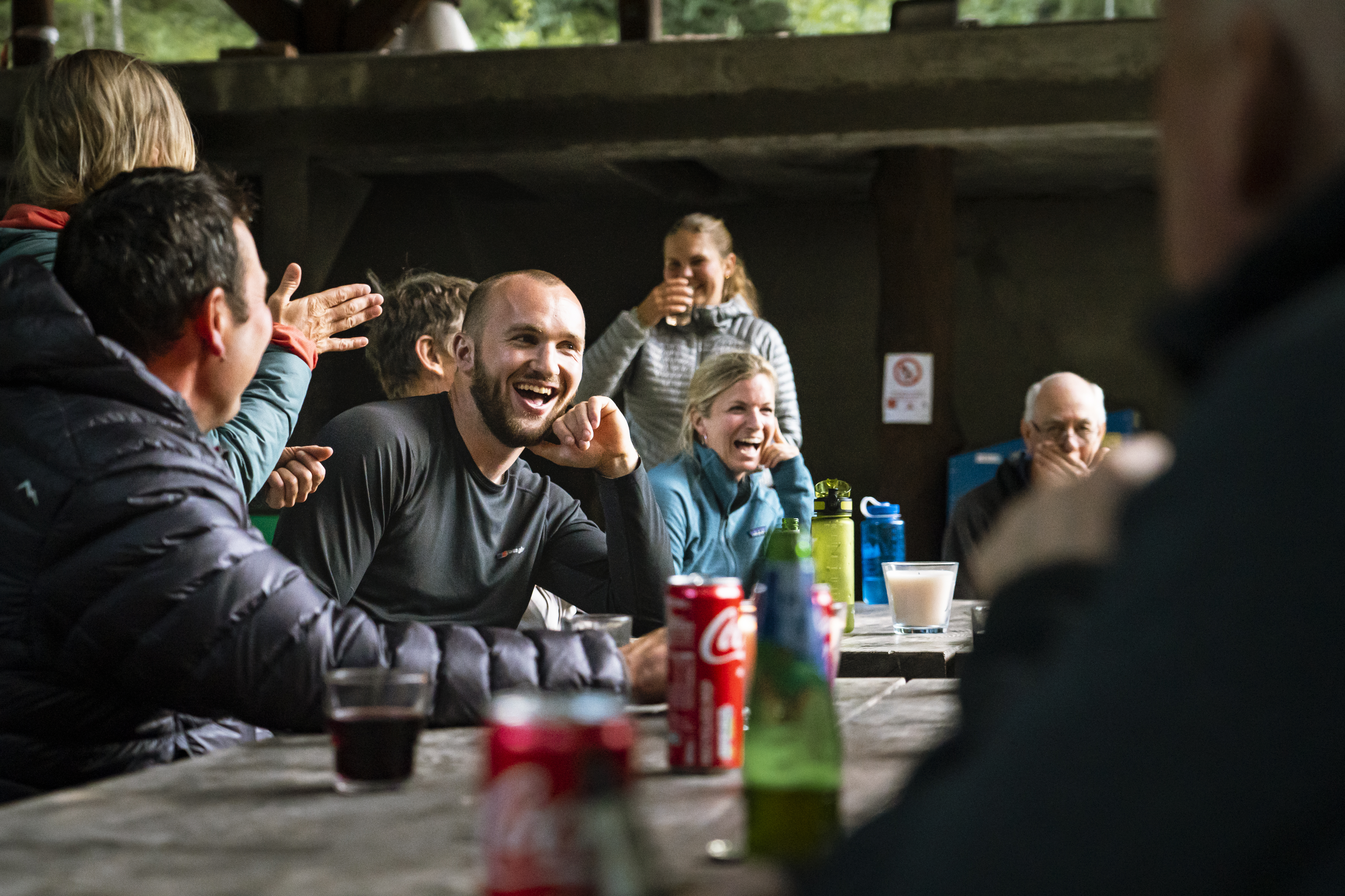
Preparation: The cumulated fatigue of hard trekking for two weeks should not be underestimated. As this is a group trip, you need to be confident your fitness will allow you to enjoyably walk at a consistent and steady pace that matches the group average, therefore allowing the group to finish the day at a reasonable time. You will also enjoy the trek a great deal more if your fitness allows you to walk the route in relative ease.
Tour leader: There is one qualified International Mountain Leader (IML) that accompanies the group throughout and it is their decision if you accompany the group on any particular day. For safety reasons, the group leader may also change their walking style from one where everyone walks at their own pace to one where the group walks together at the speed of the slowest, depending on the conditions, weather and visibility.
Accommodation: While camping, the support leader will put up your tent; in the morning, you will be expected to pack away your own tent (these are modern pop-up tents that are very easy and quick to fold away and pack) and the whole group generally helps to load the support vehicle on the days when we move camp. After breakfast and on the nights when we eat in camp, expect to help with the washing up.
Opting out: If you are unable to walk during the itinerary and want to opt out of a day, please note, this can sometimes be a little tricky. To reach the next point, you need to take a public bus or train (which run at limited times) or taxi (which can be expensive in more remote locations). Our support vehicle is not suitable for taking passengers, so please be aware of this when deciding to book this trip. If you miss a part of the itinerary, any extra transport, hotel and food cost will be at your expense.
GPS measurements: All ascents, descents and distances listed have been measured by our local partner using satellite-based mapping software. Please note, GPS measuring devices can give differing results, especially in mountainous terrain and on winding paths. Measurements stated throughout these Trip Notes are given to help you understand the types of terrain and distances you will encounter. Timings stated include lunch and photo stops and will vary depending on the pace of your group.
Ved skriftlig aksept av vårt tilbud bekrefter du/dere at våre betingelser er både lest og forstått og at evt kansellerings gebyrer kan tilkomme ved en evt. avbestilling av reisen.
| sdsd TILGJENGELIGE DATOER | PRIS (1 VOKSEN) | PRIS (1 BARN) | Enkeltromstillegg | STATUS REISE |
|---|
| TILGJENGELIGE DATOER | PRIS (1 VOKSEN) | PRIS (1 BARN) | ENKELTROMSTILLEGG | STATUS REISE |
Vi vil komme tilbake til deg med et tilbud på den forespurte reisen/pakken I løpet av 48 timer. Alle tilbud er uforpliktende og er vanligvis gyldige i 7 dager. Vi gjør oppmerksom på at reserverte tjenester kan bli kansellert innenfor disse 7 dagene og at pris kan endres inntil en endelig bestilling er mottatt.
SEND FORESPØRSEL